When we look at something from a different perspective, we usually see something new—something we might have not seen before or something familiar seen in a new context. Discovery of the new is precisely why we’ve recently started to explore ways to look at landscapes and ecosystems from a new perspective—namely, from the air. With very simple and affordable components such as helium balloons, kites, and point-and-shoot cameras, we’ve been able to capture great aerial images of the BRIT campus. And with some rather sophisticated software (details below) we were able to analyze the images to create a number of products that are valuable to our ongoing understanding of landscapes and ecosystems.
Hasn’t this already been done?
When we first posted our aerial survey imagery online through Facebook, some people wondered why we would bother doing this when comprehensive aerial imagery is available from Google and other sources. This is a great question, but we have some really good reasons for conducting our own aerial surveys.
The first and most important reason is that we can perform surveys at precise times that align with our research goals. For example, we were able to survey our prairie the day before the horses arrived and soon after they departed. This allowed us to determine the impact that the horses had on our prairie. We plan to continue periodic surveys of our prairie and other locations to be able to monitor changes in plant growth and composition over time.
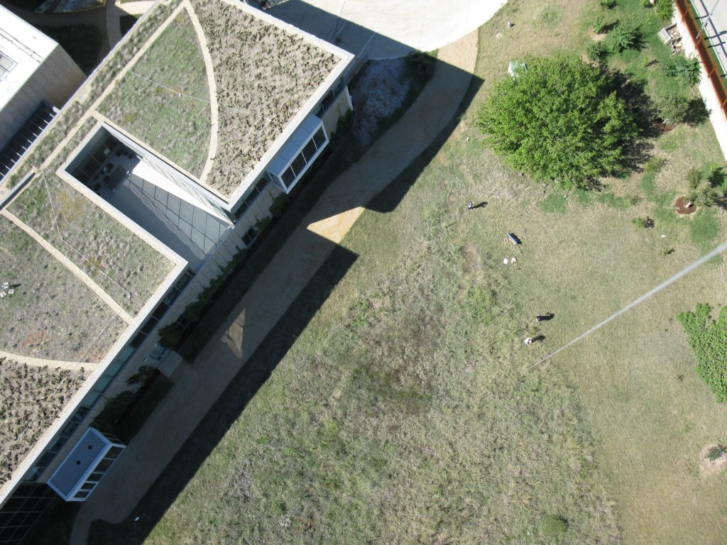
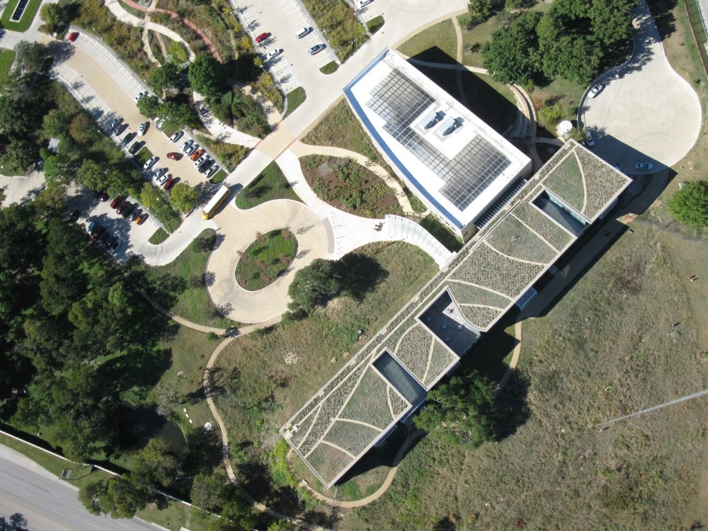
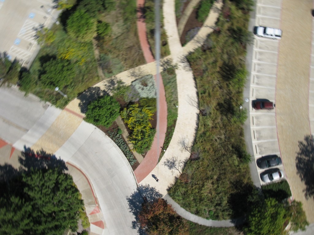
Another reason we conduct our own surveys is image resolution. The satellite imagery that is typically provided by Google in urban areas is at a resolution of 2.5 meters, meaning that an object measuring 2.5 meters on the ground would measure one pixel in the image. With our own imagery, we had a resolution of 0.02 meters or 2 centimeters per pixel! In more concrete terms, that means that a U.S. quarter would be visible on the ground and would measure one pixel across in the images we captured. This kind of resolution allows us to identify plant species in many cases.
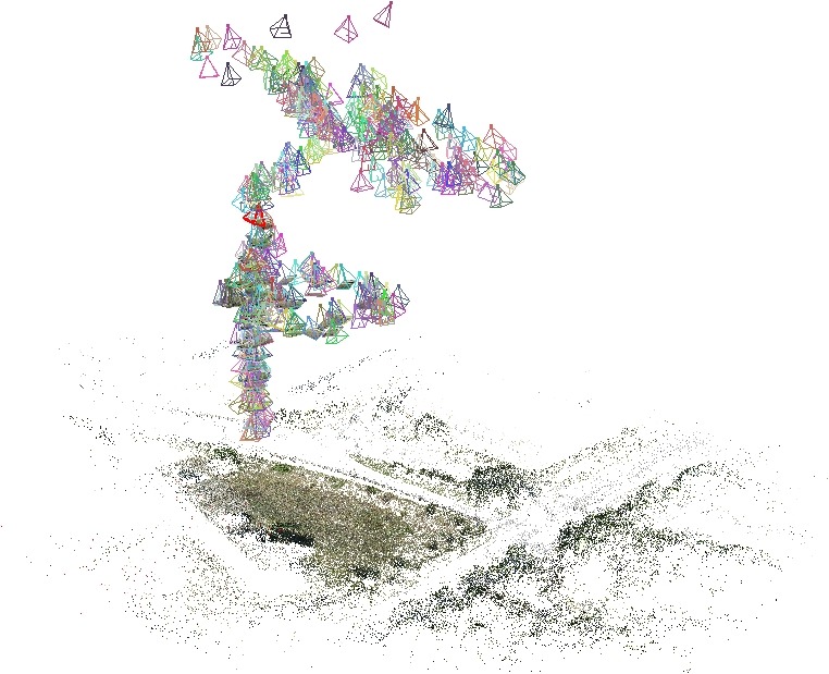
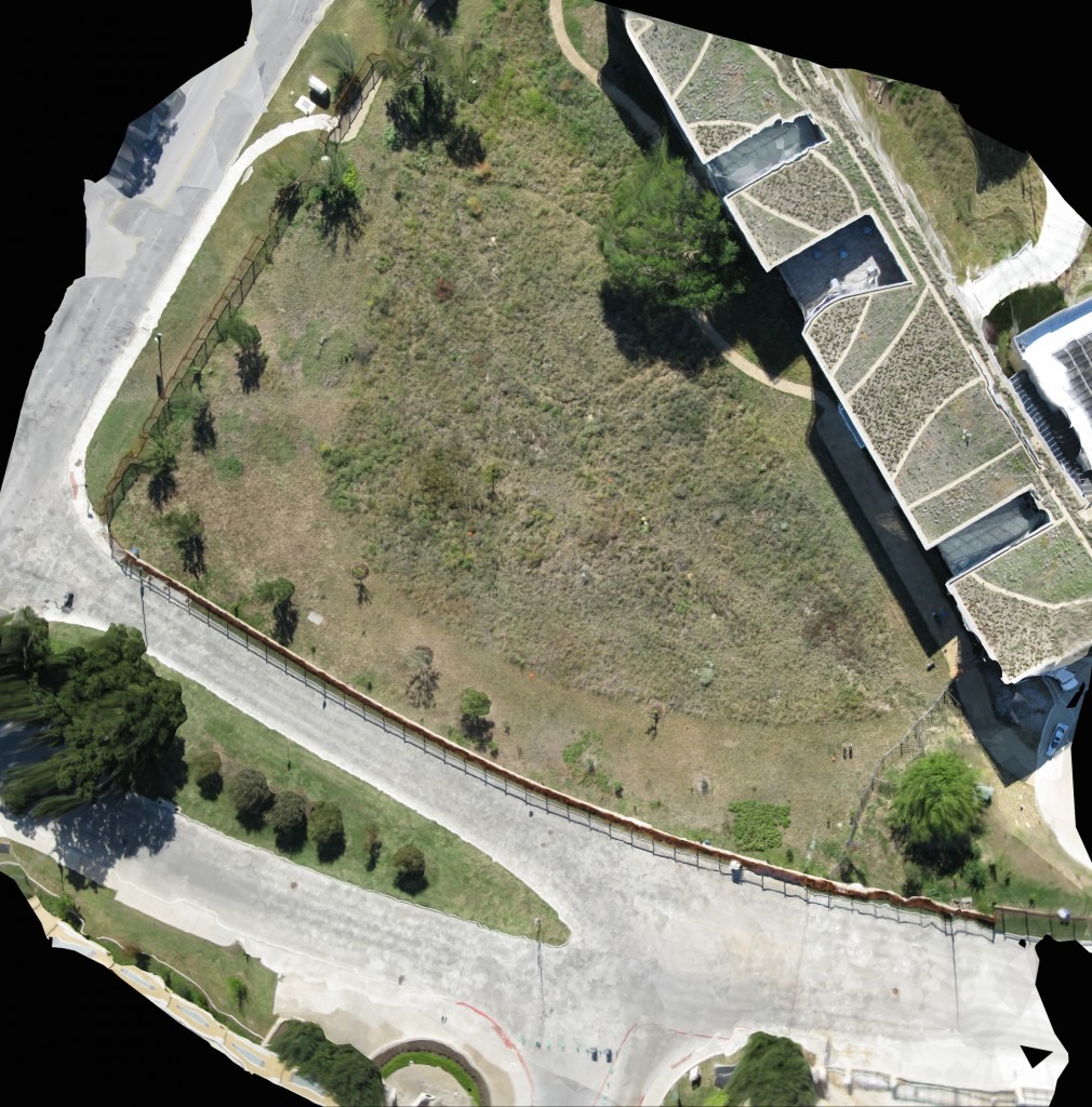
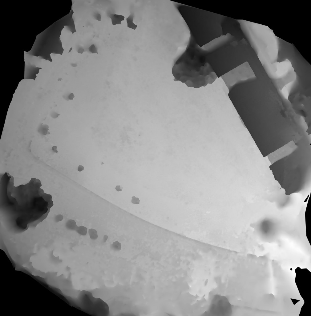
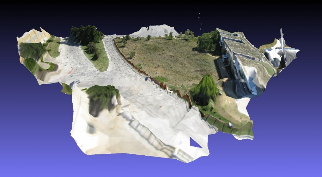
Finally, our method of capturing the landscape with multiple images from multiple locations (as the camera moves above the ground) allows us to perform some really interesting and powerful image analysis that would not be possible with Google or other imagery that is only a single, two-dimensional image. I’ll explain this briefly in the products section below and in greater detail in subsequent posts.
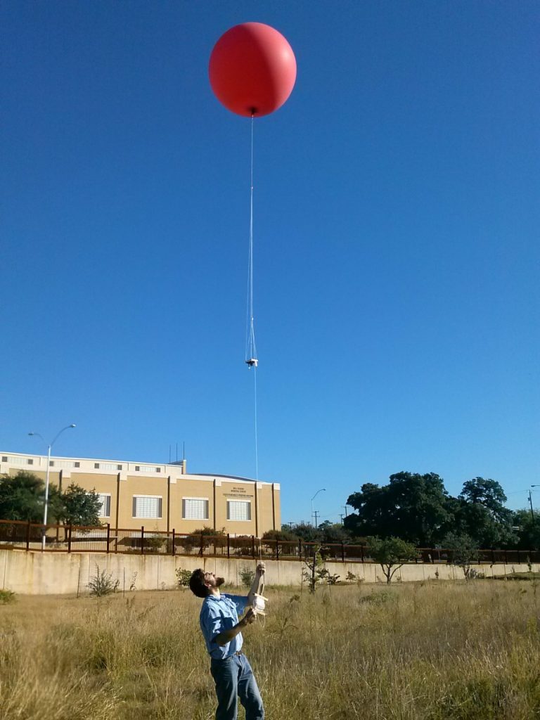
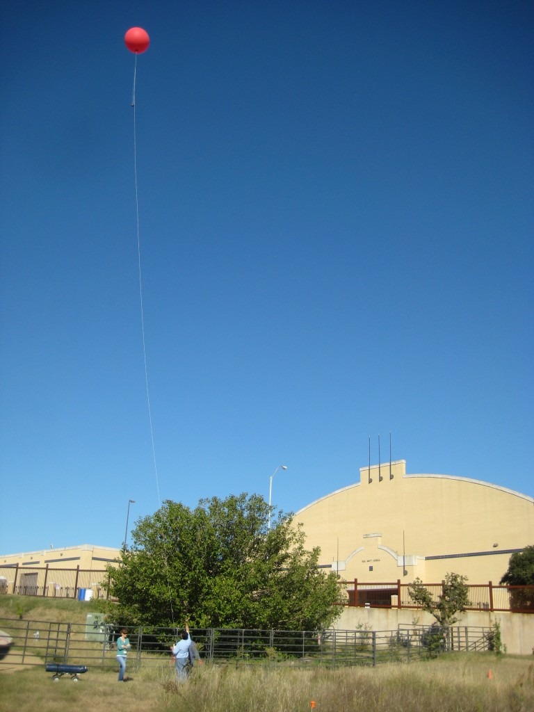
We started this project with a great set of tools and information from Public Lab (www.publiclab.org), an organization that has developed a number of open-source tools for environmental exploration including kits for balloon and kite mapping. Kites have a long history as systems for aerial surveys, and our initial plan was to conduct our surveys using the kites we bought through Public Lab. The problem was that the weather just didn’t always cooperate. On days when the wind isn’t blowing much, helium balloons still allow us aerial access so our first surveys were conducted with a helium balloon. However, at the end of February, we were lucky enough to have some steady winds that allowed us to perform our first kite survey with help from the Green Revolution students (details coming in a future blog post).
The Survey Process
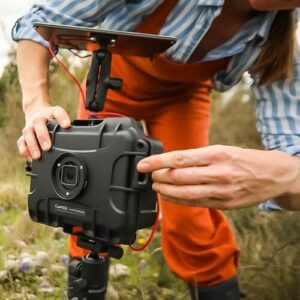
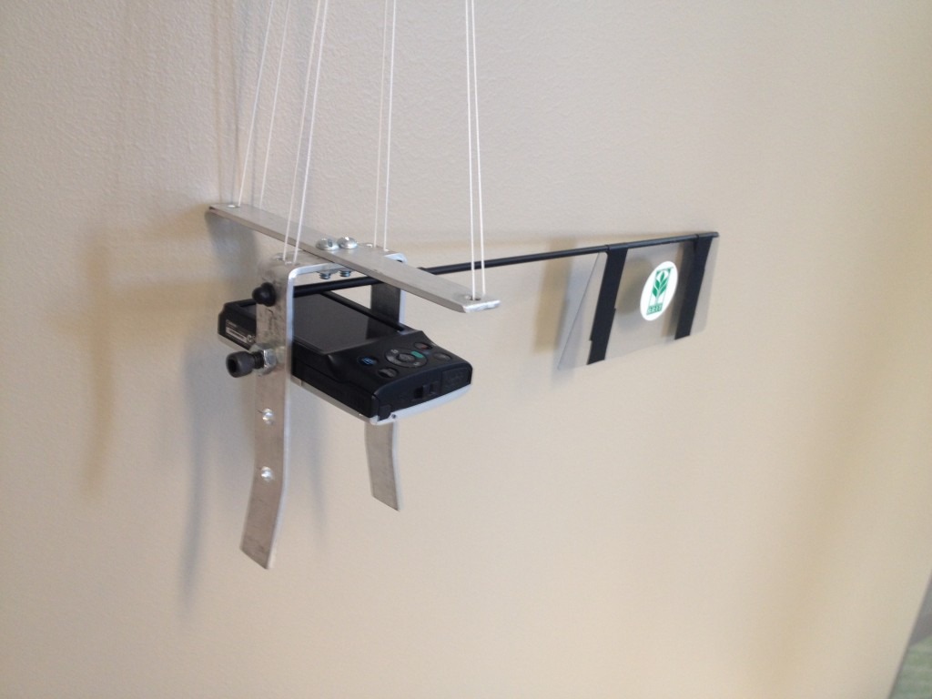
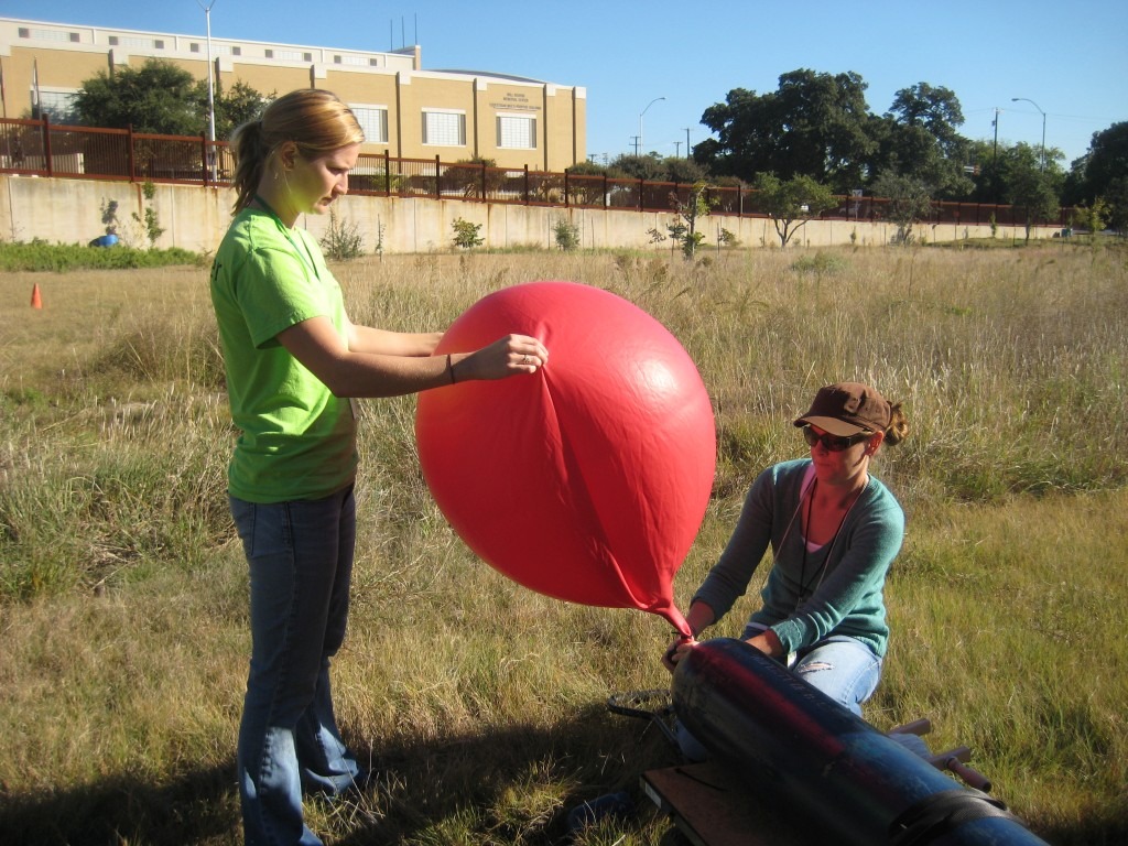
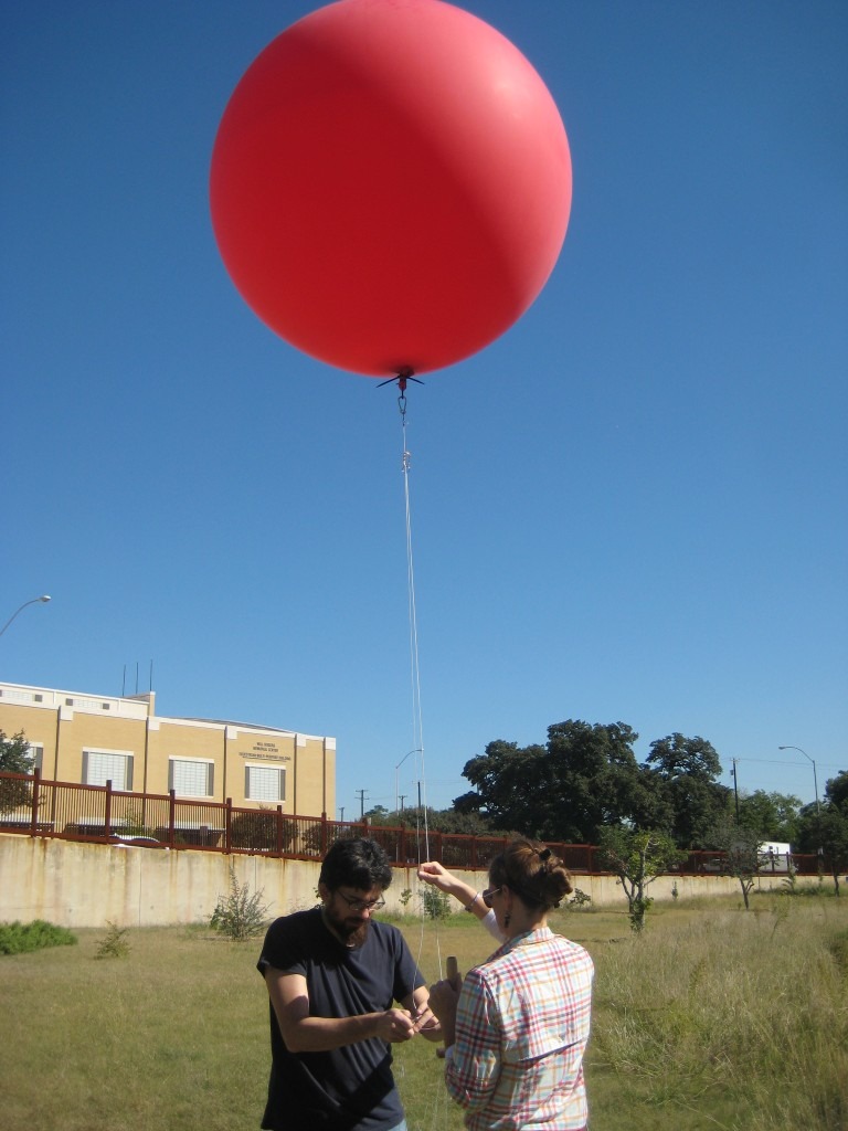
Using the Public Lab balloon kit, some helium, and a custom-built camera rig with a basic Canon point-and-shoot camera, we performed three aerial surveys in October and November of 2013. Below are some pictures from these surveys that demonstrate the basic process.
The Products
On our first balloon survey, we collected 378 images of the BRIT prairie. Each of these provides a high-resolution image of the prairie from a perspective we’ve never seen before. But great images aren’t all we can get from these surveys. With a variety of powerful software and analysis techniques, we’re able to generate a number of different products from these images. Below is a small sample of such products with brief descriptions, but we’ll explore these in greater detail in a future post.
Next Steps
We will continue to survey our BRIT prairie and record changes over time, but we also intend to expand our aerial survey program to include surveys of other, larger landscapes and ecosystems as well as to experiment with the use of unmanned aerial vehicles (UAVs), also known as remote controlled planes and copters. Keep your eyes open for more posts about some of the technologies behind the image analysis and future aerial surveys!